emsCharts

Geocoding
Geocoding is the process of assigning Latitude and Longitude coordinates to all addresses (referring, receiving, and patient addresses). After coordinates are assigned, mileages are auto-calculated, bio-surveillance alerts can be setup, spatial analysis reporting can be performed to view EMS incident plot densities, and statistical reports can be run.
How it Works
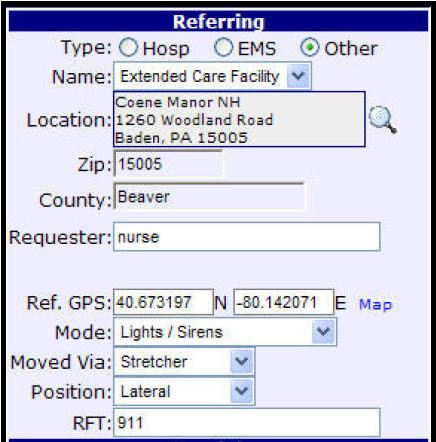
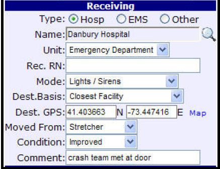
emsCharts automatically assigns a Latitude and Longitude coordinate to addresses in the electronic patient care record.
Geo-coding Functionality Auto-calculates mileage (air or ground) between two pointsemsCharts references MapQuest to determine the shortest driving route or straight-line distance between two locations (for air).
Bio-Surveillance AlertsSetup alerts (via email) to notify you when a threshold number of calls is reached determined on location and frequency.
- For example, a FLU 10 10 10 alert would be setup as follows: 10 Flu-like symptom calls within 10 hours within a 10 mile radius.
- For example, a Overdose 5 5 5 alert would be setup as follows: 5 Narcan administrations within 5 hours with in a 5 mile radius.
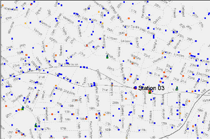
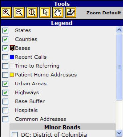
Display all of your EMS incidents on a map. Specific calls can be filtered by based on call, date range, call type, call location, etc.
Reporting- Closest Trauma Center Report
- Distance Between Base and Call Report
- Time Between Base and Call Report
- Closest Base Report
- Mapping
Simple and Easy - Confirm that your Basesite code table has addresses for all your Basesite locations and click on the Re-Geocode button. emsCharts will do the rest!
Geo-coding Value- Eliminate the need for crews to enter mileage
- Achieve better compliance with mileage to the tenths-of-a-mile
- Standardize distances between locations in your service area
- Create visual representation of your data for a different point of view